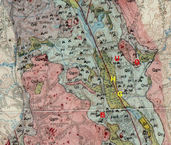
(from Chute, N., 1959. Glacial geology of the Mystic Lakes - Fresh Pond
area, Massachusetts:
U.S. Geological Survey Geologic Bulletin 1061-F, p. 187-216)
(from Chute, N., 1959. Glacial geology of the Mystic Lakes - Fresh Pond
area, Massachusetts:
U.S. Geological Survey Geologic Bulletin 1061-F, p. 187-216)